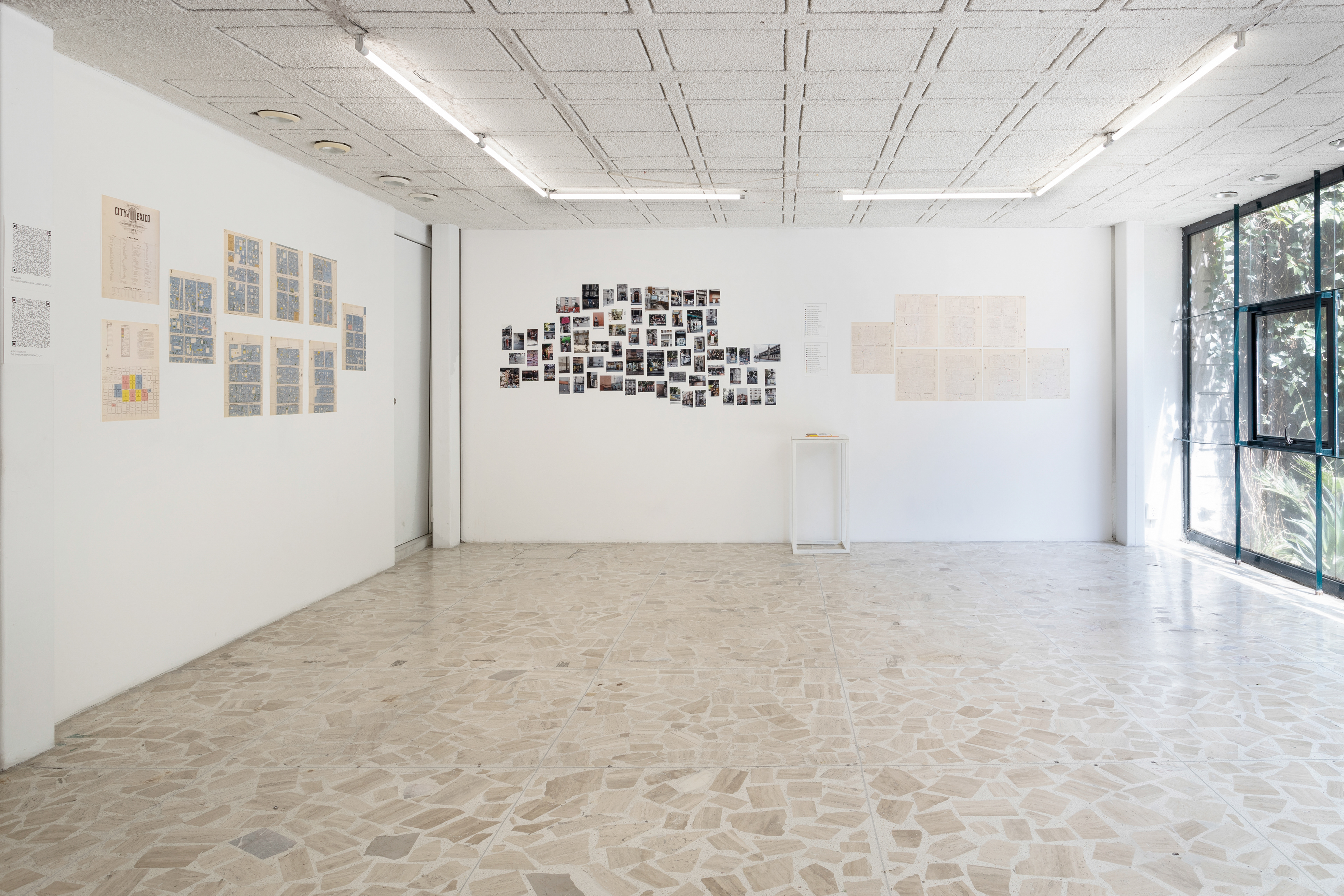
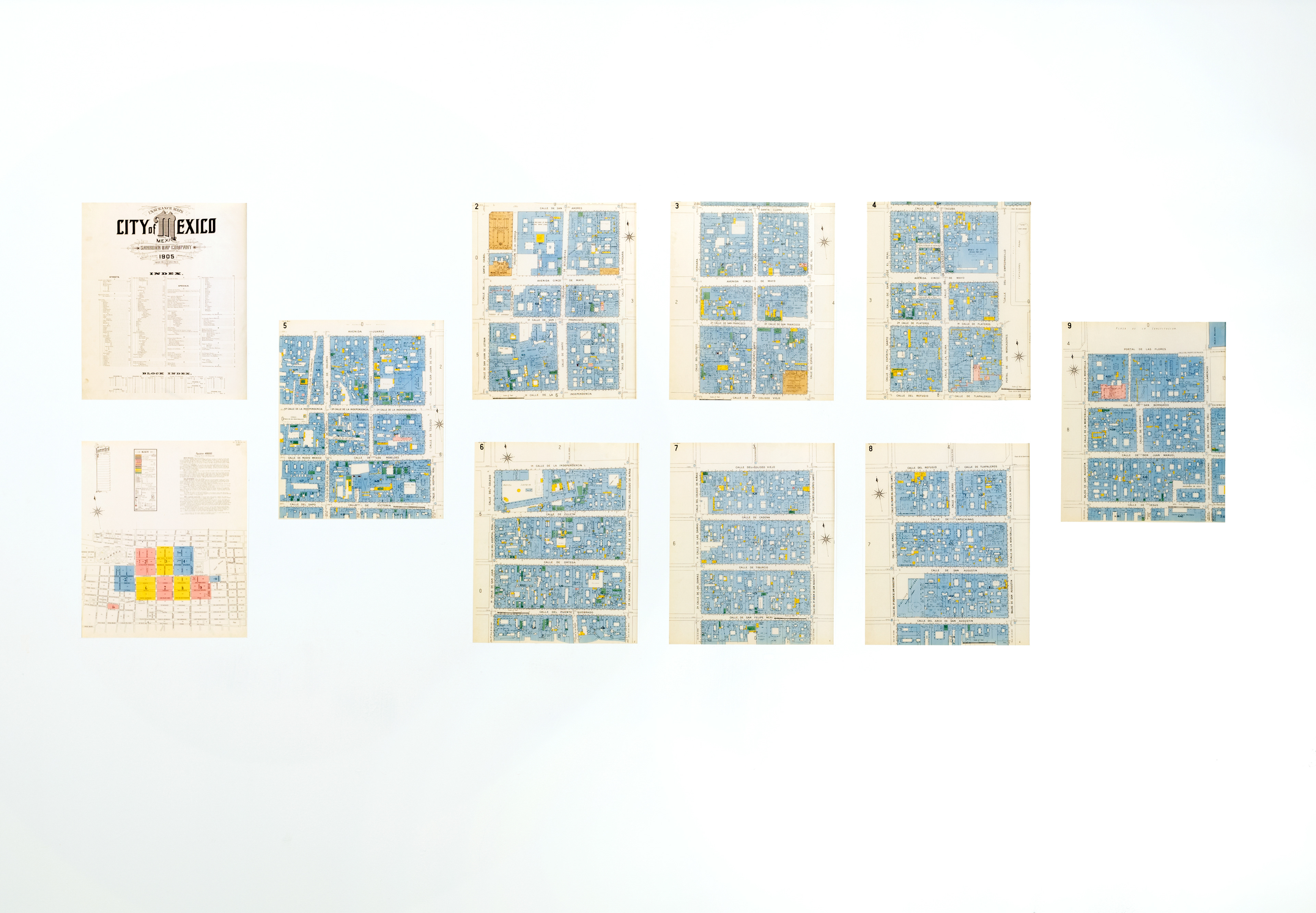
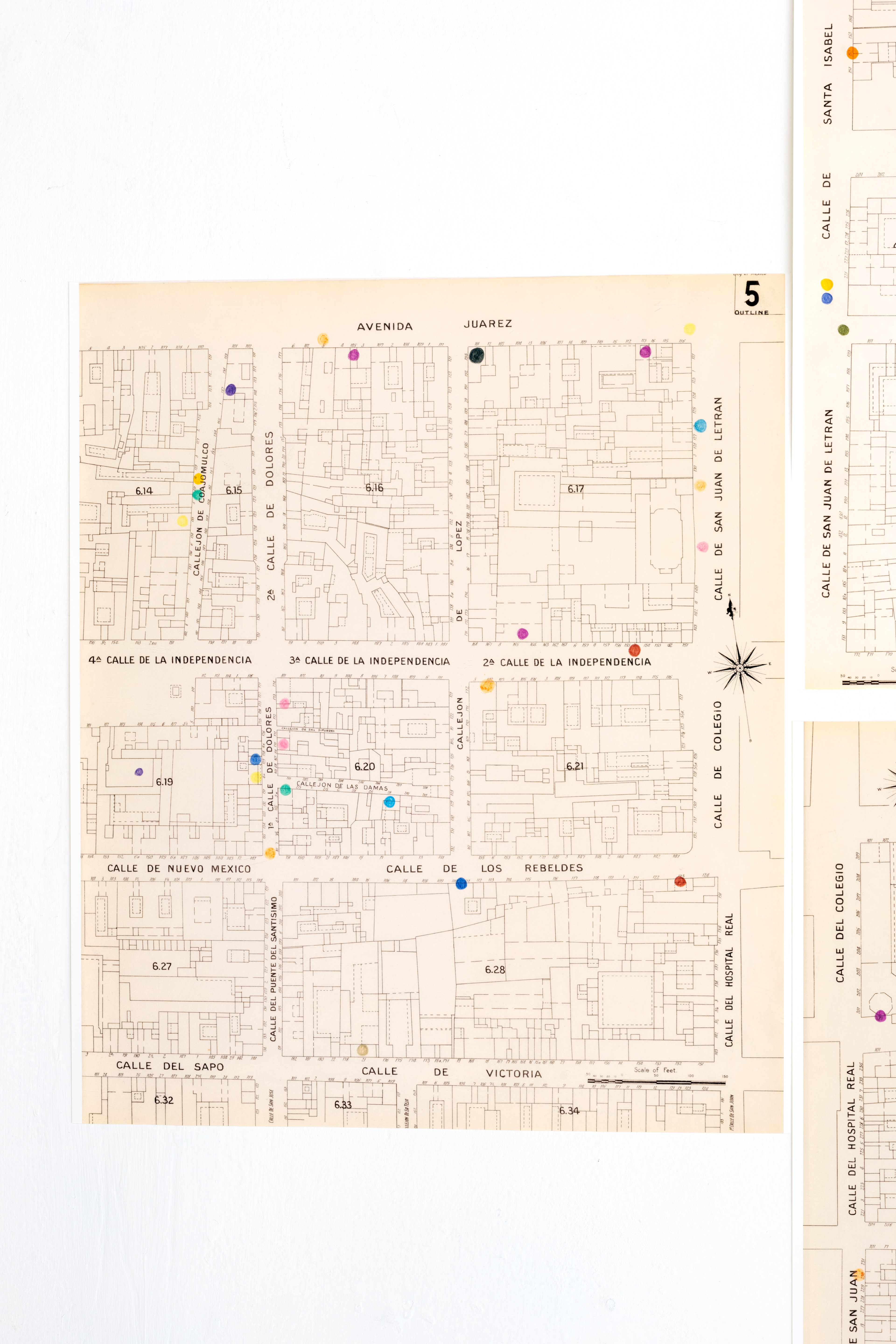
Cartografía de riesgo maps historic and contemporary risk, physical and emotional risk, personal and public risk, in the historic center of Mexico City. As an interpretive guide, the project used a 1905 map that was made by the Sanborn Map Company to evaluate the risk of fire. It used the Centro Historico locations of Sanborns restaurants - an iconic chain founded by Americans in 1903 and now owned by Mexican business magnate Carlos Slim - as interpretive anchors.
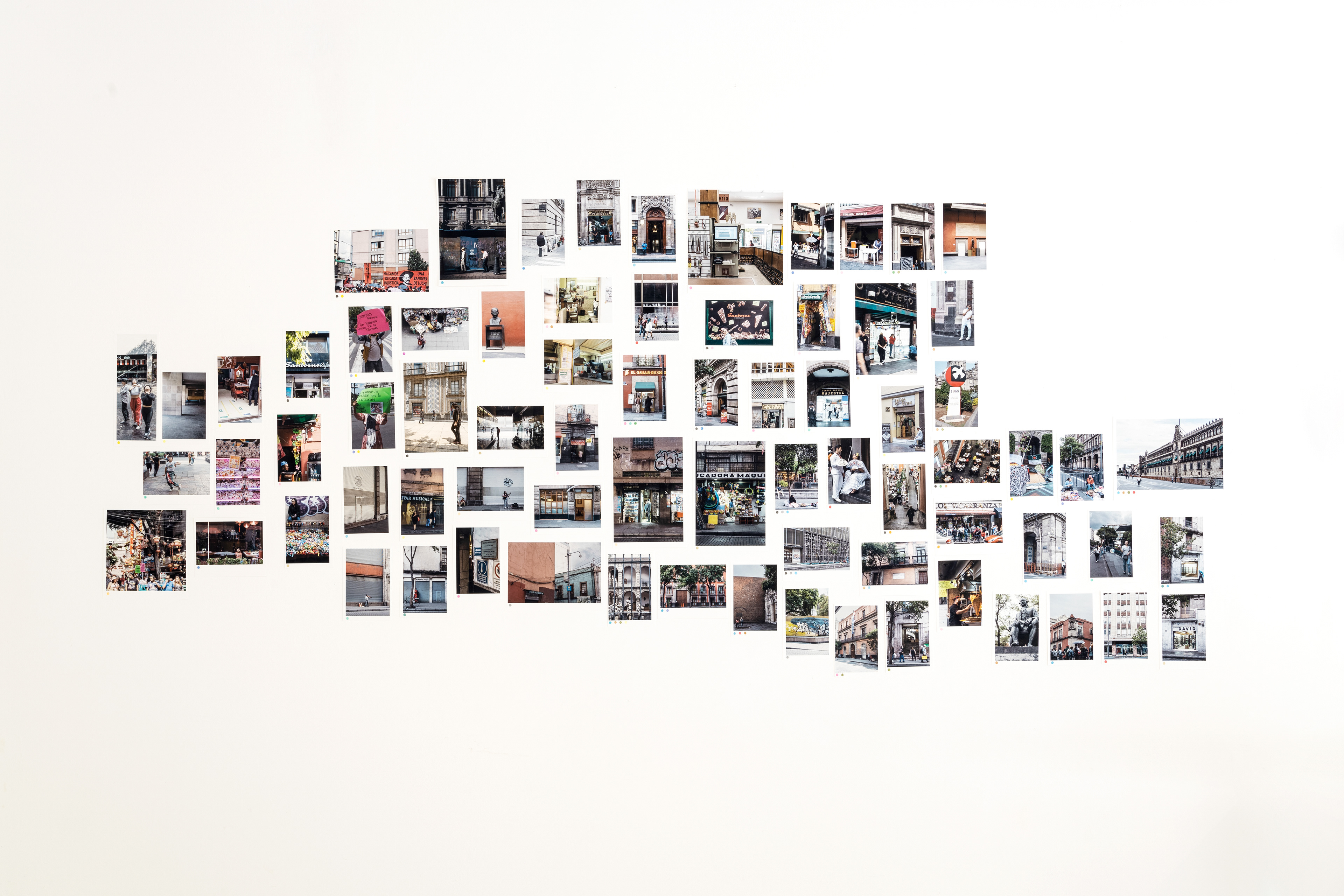
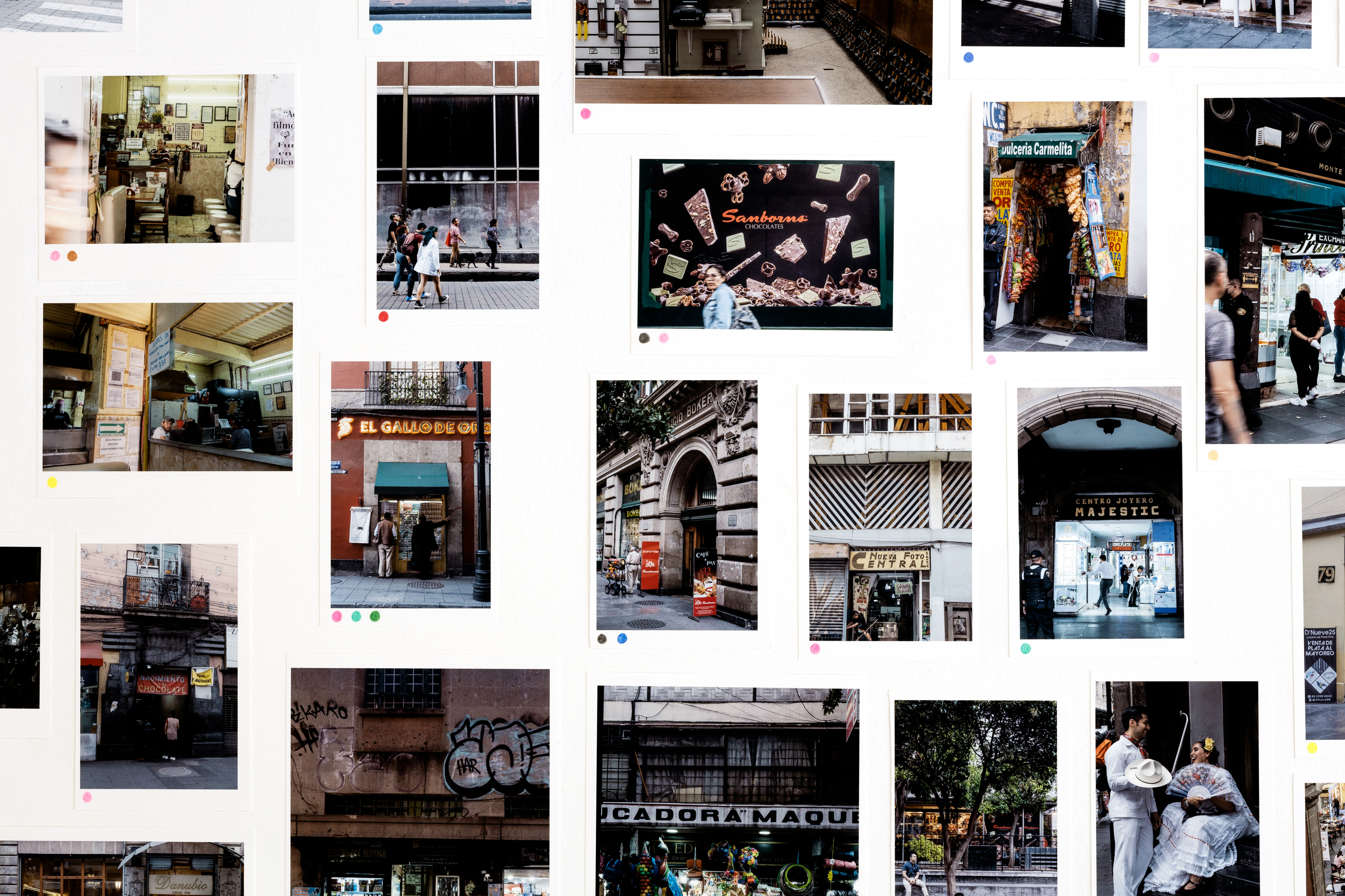
The project, developed during a residency at Casa Lü, culminated in a three-part exhibition. In the first part, the 1905 map was paired with an audio guide. (Available here in English and here in Spanish.) The second part was comprised of a photo map of images taken as I explored the Centro comparing the 1905 maps with present-day geography and conducting my own evaluation of risk.
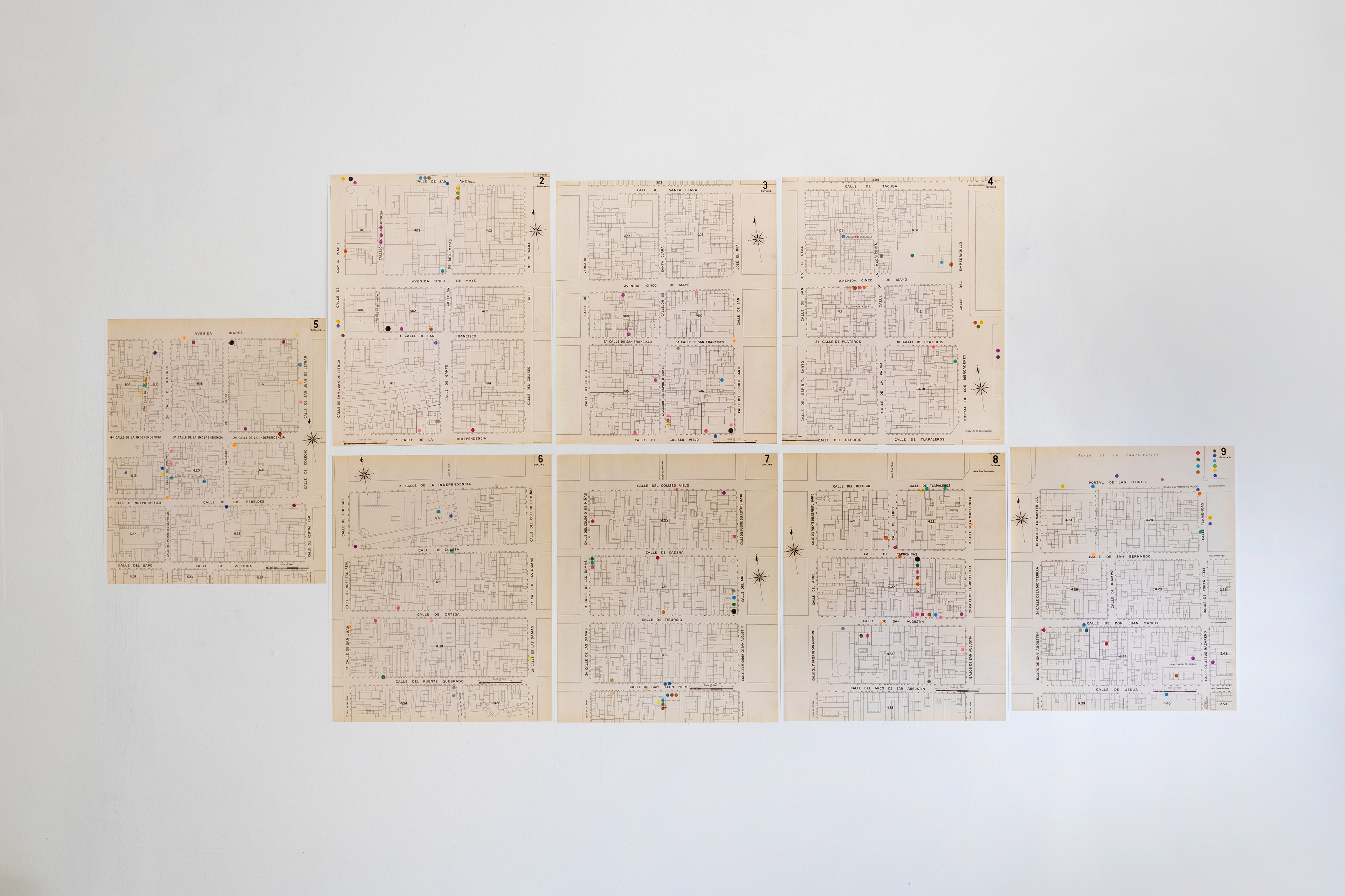
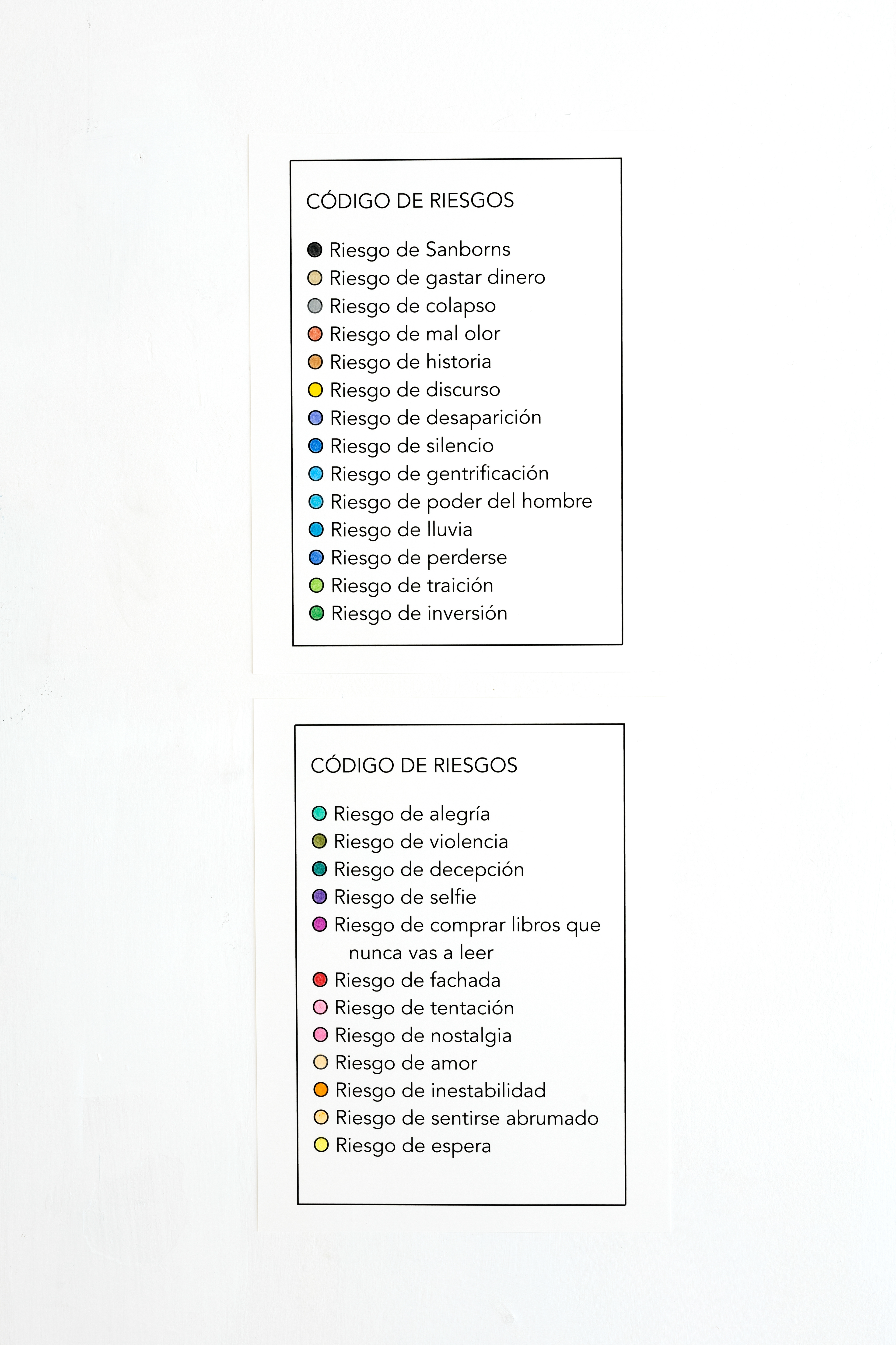
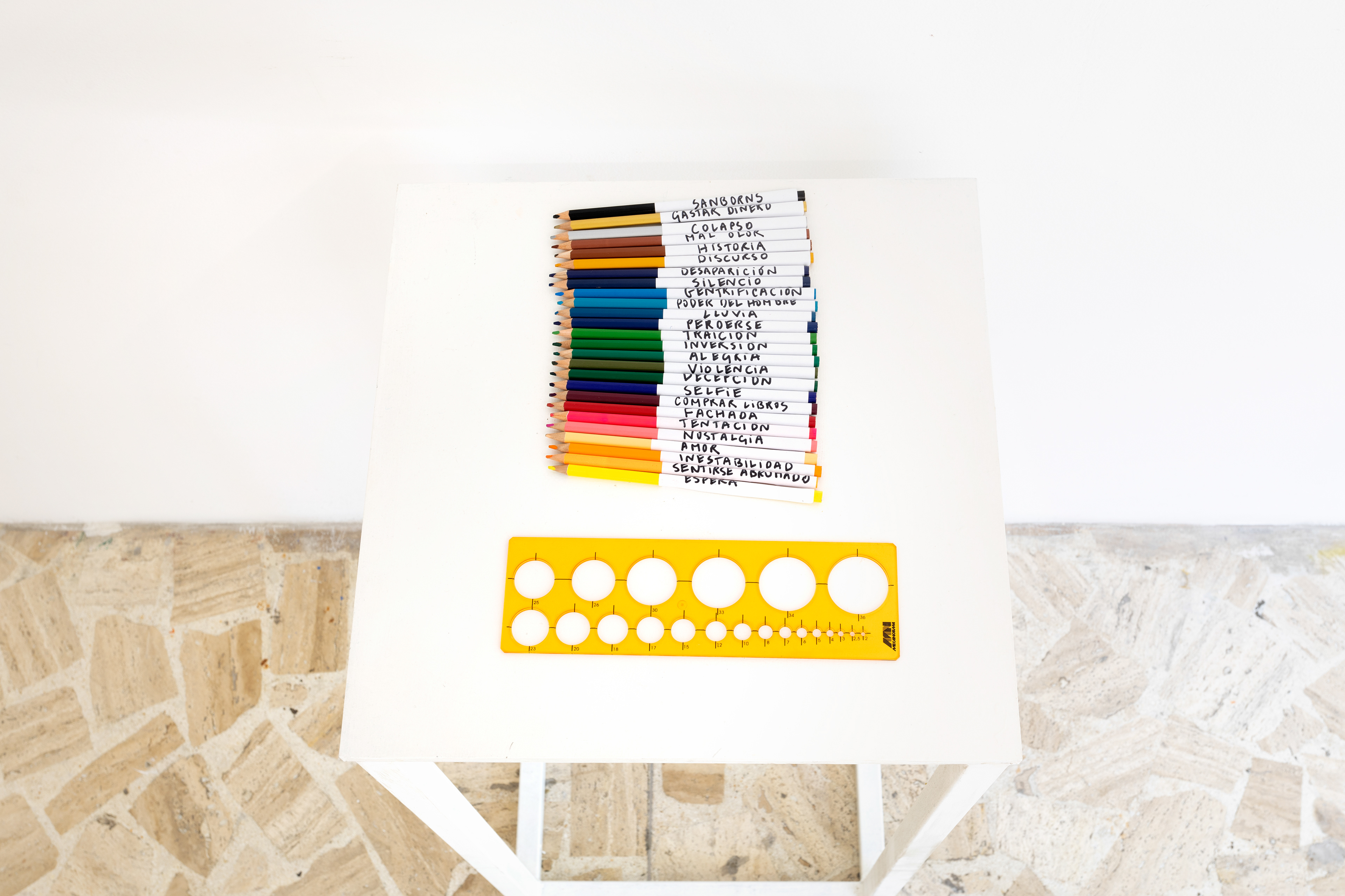
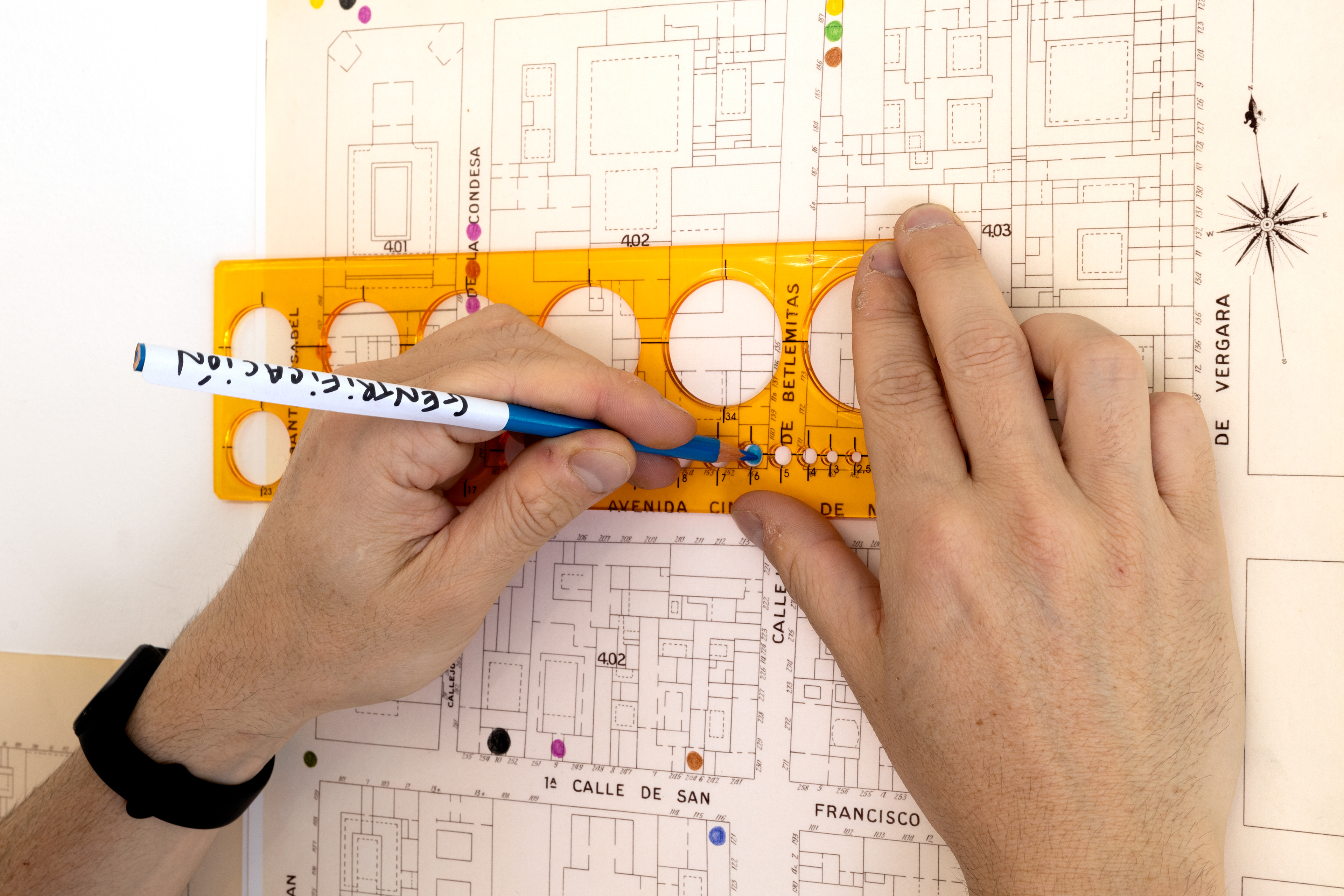
The third part was a new map laid upon the outline of the 1905 map. This was created collaboratively through a workshop with Mexico City residents and through participation at the exhibition. Participants in the workshop walked through the center with the 1905 map as a guide, thinking about the risks they encountered in an expansive and emotional way. They then marked their risks on the new map using a color-coded system. Visitors to Casa Lü were invited to engage in a similiar thought process as they viewed the exhibition and then placed their own risks upon the map.